Modern geodynamics of Tien Shan as the fundamental problem
Magnetotellurics as a geophysical tool of deep studies
The Tien Shan region should be considered as the dominant and the most active element of the Central Asian geodynamic system (Makarov, Trapeznikov etc., 1996). Although the system has received a detailed geological and geophysical study, there are significant disagreements in understanding the nature of neotectonic structures and the latest orogeny of the Tien Shan as a whole. This fact reflects the complexity of modern geological processes occurring here. The basic polar opinions come either to the idea about the folded nature of the latest bends and uplifts and their formations in conditions of lateral folding of the crust, or to the idea about their clumpy nature and their formation as a result of the vertical differentiated movements of the Earth's crust. These latest deformations can be explained as a consequence of the India/Eurasia collision.
Besides the lateral forces of pressure of Pamir Arc on mountain massifs of the Tien Shan, V.Makarov and Yu.Trapeznikov suggested to consider one more additional and independent mechanism of neotectonic deformations in the Earth's crust related to the active processes of structural and material transformations, flow and spatial reallocation of deep layers of the Earth's crust and underlying mantle. Apparently, the combination of these two fundamentally different sources of tectonic forces causes the most complicated dynamics of deformations of the Earth's crust. It is extremely important to distinguish the components of tectogenesis. At this point, the deep electromagnetic soundings act as a "geophysical arbitrator". It is magnetotellurics that gives information on deep fluid mode, zones of dehydration and partial melting. Given information is very important for the assessment of reliability of any hypothesis about the deep structure and dynamics of the Tien Shan.
Creation and Application of Magnetotelluric Research Complex at the Frunze (Bishkek) Proving Ground.
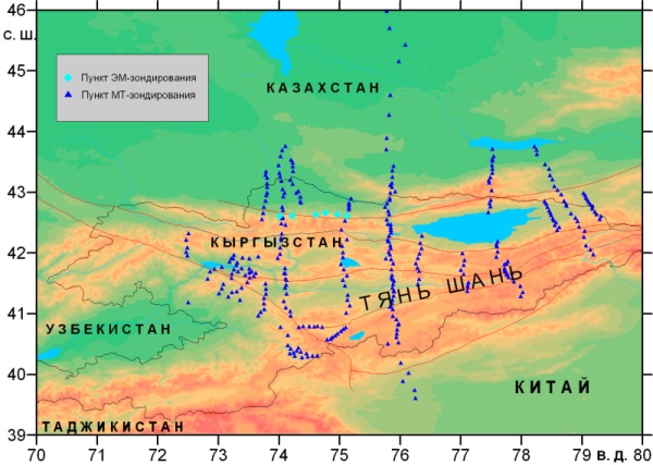
Magnetotelluric complex plays the major role in multiparametric geophysical research of the Tien Shan region. The complex consists of three components: magnetotelluric sounding, deep magnetotelluric sounding and magnetovariational sounding. The soundings have been carried out along six regional profiles that cross the territory of the Tien Shan (fig.1). Talas-Fergana fault and Tarim platform make the southern border of these profiles. All of them cross the seismogenerating zone of the northern Tien Shan, and pass along the flanks of seismogenerating zone revealed in the Central Tien Shan. We have carried out the detailed works at a series of local profiles to specify the geoelectric parameters of objects revealed by interpretation of electromagnetic data for these profiles. By now, there are already seventeen short profiles.
 |
|
Fig.1. The layout chart of magnetotelluric observation sites: 1 – sounding site, 2 – long-period sounding site, 3 – the number of regional submeridian MT-profile, 4 – indication of sublatitudinal deep MT-sounding profile, 5 - basic faults, 6 - frontier of Kyrgyzstan. |
The study of the deep structure of the Kyrgyz Tien Shan by methods of magnetotelluric sounding started in 1984 from the territory of Chuy depression.
 |
|
|
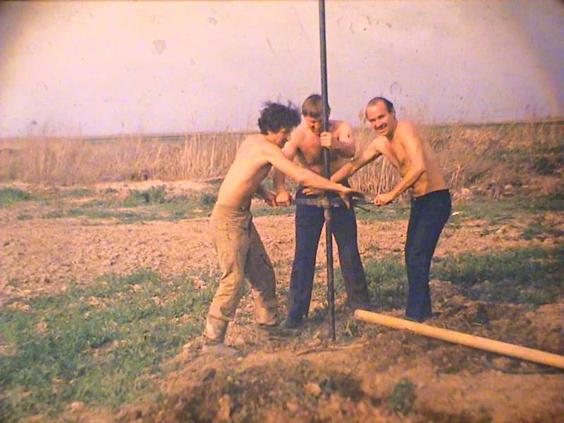
The soundings were carried out by ЦЭС-2 stations with 100-meter long electric dipoles. Magnetic field component was measured by magnetometers and ЦЭС-2.
 |
 |
|
Digital electromagnetic prospecting system ЦЭС-2 |
Installation of Hz inductive sensor |
The measuring equipment was oriented along the length and breadth of the basic geological structures, latitudinal direction (axis X) and meridian direction (axis Y). The frequency band 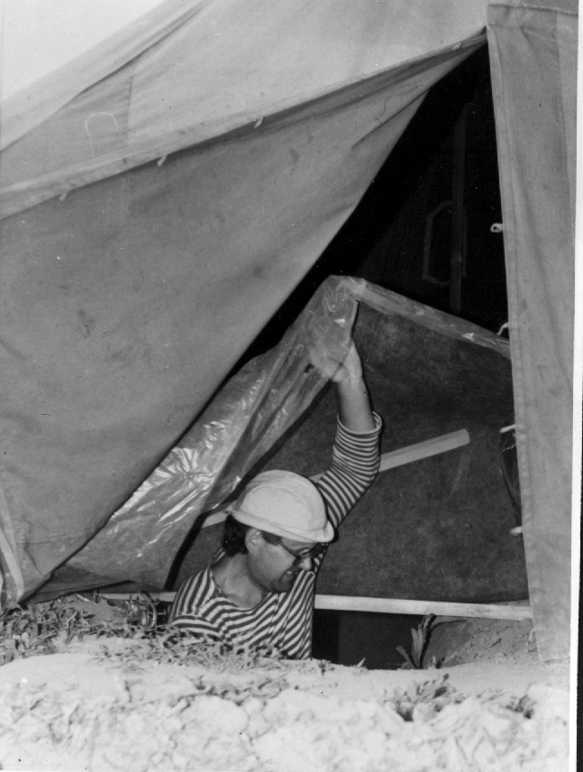 of the recorded magnetotelluric fields (MT-fields) made up from 0,1 up to 1800s. The span of profile sounding was about 10 km and the distance between profiles was about 20 km. Profile orientation was submeridian, i.e. transversely the stretch of the basic structures. Works beneath the Chuy depression revealed the conductive crusted layer at the depth of about 30 km with conductivity of 300 Ohm-1. The measurements in Chuy depression were followed by the regional research of the mountain areas of the Tien Shan by the method of magnetotelluric sounding. Presently the research goes on.
The year of 1988 can be considered as the reference point of conducting the full-scale magnetovariational investigations and understanding their place and role studying deep geoelectric processes of the Tien Shan. Since then, together with the Voronezh State University, we began to carry out the basic deep MT- and MV-observations using the analog stations МЭВС ИЗМИРАН-5.
A.Barabanov from Voronezh State University
services the МЭВС ИЗМИРАН-5 station (1988)
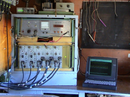
In succeeding years, of all the three components of the alternating magnetic field were recorded by the digital stations ЦЭС-2, and later, by the field computerized measuring complexes МТ-ПИК developed by the staff of the Research Station of Bishkek proving ground [Ilyichev etc., 2000] During the same year, we made first calculations of two-dimensional models to understand and explain the profile magnetovariational observations.
 |
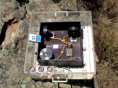 |
| МТ-ПИК Station | Block of magnetometers (Bobrov’s design) |
Quantitative interpretation of МТ and MV-data was based on the analysis of 2-D modeling and 2-D inversion. Initial 1-D models were chosen with the help of the controlled S-interpretation [Berdichevskiy etc., 1989]. Originally, we used the two-dimensional modeling program of M.Yudin [Yudin, 1985]. Most of the 2-D modeling and the 2-D inversion of MT and MV-fields were performed using the program package, developed at the Institute of Geoelectrics by I. Varentsov and his colleagues [Varentsov, Golubev, 1979]. We also used the program of 2-D modeling by Vannamaker-Palshin and the program of quasi-three-dimensional film modeling by Veidelt-Palshin.
By now, the Research Station RAS has conducted more than 800 magnetotelluric soundings of the Central and Western Tien Shan in an interval of the periods from 0.1s up to 30 minutes, and about 100 deep magnetotelluric soundings covering the periods of an interval from 0.1s up to 3 hours. In 1999, within the framework of the multidisciplinary project on studying geodynamics of the Tien Shan jointly with geophysicists from Californian university S. Park and R.Belinski, we conducted the unique field soundings using three types of measuring MT-systems: МТ-ПИК (Research Station); MT-24 (ЭМИ, the USA); LIMS (Phoenix, Canada). We obtained the МТ and MV-data in a broad band of the periods from 300 hertz up to 8-12 hours. Fourteen observation sites with the span of 20-30 km, which are located at a 360-kilometer profile along the meridian of 76 degree of east longitude, supplemented the profile III-III (fig.1) with the basic long-period soundings.
The second important point of the given field works was the comparison of results of the measurements taken by different tools. For the comparison of equipment and technologies of measuring and processing, we carried out joint measurements in two points of the profile by two stations: МТ-ПИК and МТ-24. The comparison of the obtained impedance curves has shown their good (within the limits of impedance determination error) concurrence in a working band of the periods of МТ-ПИК.
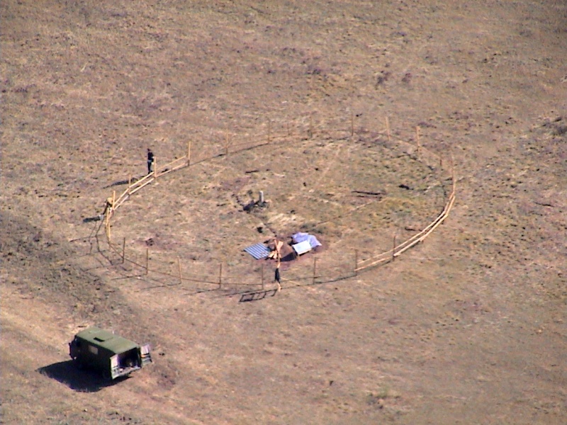
In 2003, within the frameworks of a pilot project with the Phoenix Company, we began to conduct monitoring of electromagnetic characteristics of medium by the method of magnetotelluric soundings at the territory of Bishkek geodynamic proving ground.
 |
|
Ak-Suu stationary observation site
|
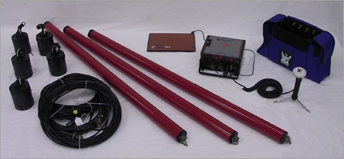
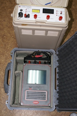
Presently, magnetotelluric soundings are carried out using measuring complexes MTU -5, V-8, AMT produced by Phoenix Company (Canada)
 |
|
Set of MTU-5 |
 |
 |
|
V8 recorder and Т-4 generator |
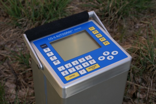
Scientrex gravimeter |


