19.09.24
Regional GNSS measurements on the territory of Kyrgyzstan in 2024. KGS24a, KGS24b.
This year, the field group of the GPS Laboratory (LGPS) based on the Global Navigation Satellite Systems (GNSS) method conducts planned field measurements of GNSS network points on the territory of the Chui, Jalal-Abad, Talas, Issyk-Kul, Naryn regions of Kyrgyzstan within the framework of the State Assignment: "Study of modern movements of the earth's crust of the Tien Shan and adjacent territories by methods of ground and space geodesy" reg. No. 1021052806451-5-1.5.1.
Repeated surveys of the same GNSS points in the study area make it possible to determine the high-precision position of the point at the time of measurement and track the long-term rate of its displacement to solve fundamental geodynamic problems, as well as to assess the danger to the population and vital facilities. From May to September 2024, LGPS employees traditionally carry out two campaigns (KGS24a from 04.07.2024 to 03.08.2024; KGS24b from 21.08.2024 to 16.09.2024).
Each team includes an operator and a driver of a ZIL-131 or GAZ-33088 vehicle. Each team measures 14-15 points per month, with 36 hours allocated for each point. The vehicle mileage during one campaign was 1,500-2,200 km. The average vehicle mileage between observation points was 130 km. Since 2020, GSDN employees have been taking GNSS measurements using Russian-made MP-8 receivers capable of recording signals from 4 satellite constellations: GPS, GLONASS, Beidou and SBAS (Fig. 2).

Figure 1 – Fragments of field GNSS work in 2024:
a) Field landscape of the team from the measurement site of the regional GNSS point;
b) Measurement at the GNSS point with the MP-8 receiver with a pin support.
24.09.21
This year, employees of GPS laboratory (RS RAS) conducted routine field measurements of the Kyrgyz GPS network sites based on the Global Navigation Satellite Systems (GNSS) method. Annual repeated surveys of the same GPS sites on the study area allow to fix the high-precision position of the site at the measurement time and to track the multi-year rate of its displacement to solve fundamental geodynamic problems, as well as to assess the danger of the population and vital objects.
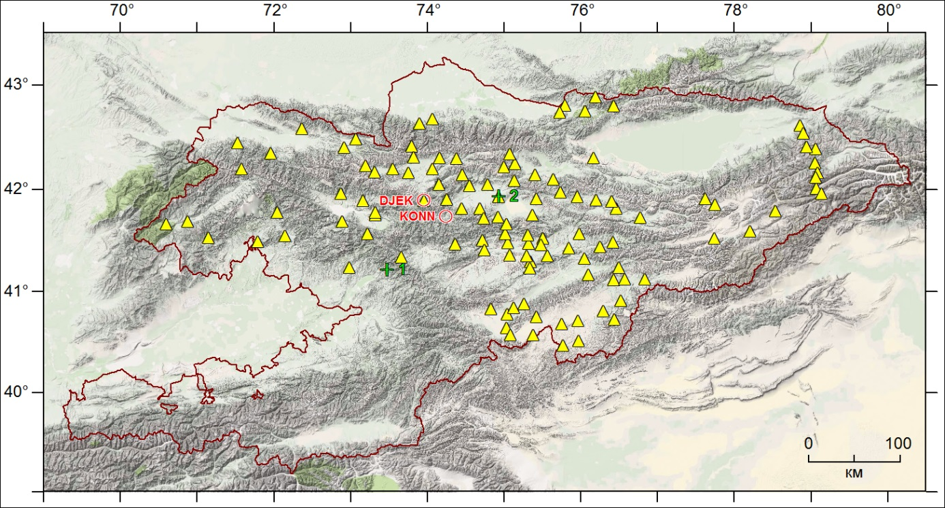
From May to September 2021, two campaigns (KGS21a from 25.05.2021 to 25.06.2021; KGS21b from 17.08.2021 to 15.09.2021) were carried out for measure regional sites on the territory of Kyrgyzstan (Fig.1).

Till 2020 the employees of the GPS Laboratory conducted measurements mainly with the Topcon Legacy-E instruments, which allow fixing the signals of GPS and GLONASS satellite systems. In the current year the works are carried out with the use of new generation devices of Russian production MR-8, which in addition to the 2 main ones are able to record additional information from the Beidou (China) and SBAS (Satellite Based Augmentation System) systems. These devices are much lighter and more compact, have an integrated design of the receiver with the antenna (Fig.2).

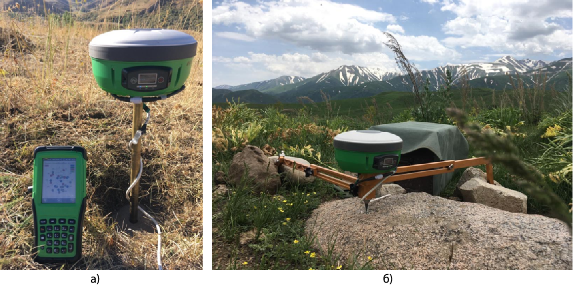
Figure 2 - GNSS receiver MR-8 under field regional measurements 2021:

